File:Nun-Kun-Suru-Valley.jpg
Size of this preview: 800 × 535 pixels. Other resolution: 1,024 × 685 pixels.
Original file (1,024 × 685 pixels, file size: 250 KB, MIME type: image/jpeg)
| विवरण (Description) | नून-कुन, सुरु घाटी |
| चित्रांकन (Author) | Eric Bézine |
| स्रोत (Source) | www.flickr.com |
| उपलब्ध (Available) | Nun & Kun, 7000m |
| आभार (Credits) | Eric Bézine's photostream |
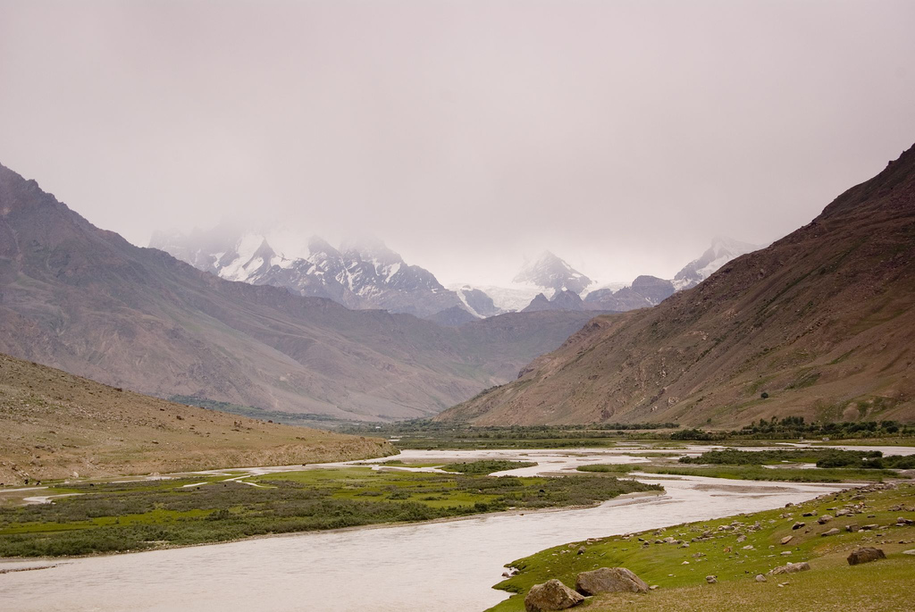
| अन्य विवरण | सुरु घाटी के सुदूर पूर्व भाग में एक जलोढ़ है। जिसके ऊपर दो चोटियाँ नून 7135 मीटर तथा कुन 7035 मीटर स्थित है। यह लद्दाख का सबसे ऊंचा शिखर है। कारगिल के दक्षिण से इस जगह की दूरी 70 किमी है। नून-कुन पर्वतों पर सुरू घाटी द्वारा पहुँचा जा सकता है। |
|
यह चित्र क्रिएटिव कॉमन्स लाइसेंस के अंतर्गत उसके 'उपयोग के अधिकारों' का हनन किए बिना उपयोग किया गया है। कृपया चित्र के उपयोग अधिकार देखे बिना उनका उपयोग न करें। इससे चित्रों से संबधित अधिकारों के उल्लंघन होने की संभावना है। |
100px|link=http://creativecommons.org/licenses/by-nc/2.0/legalcode|center
|
This file is used under the Creative Commons license. |
| 30px|Attribution Attribution - आपको चित्र के "अधिकार धारक" का उल्लेख उसके निर्देशानुसार करना होगा किन्तु इससे यह प्रतीत नहीं होना चाहिए कि "अधिकार धारक" आपके अपने कार्य का समर्थन कर रहा है। [You must attribute the work in the manner specified by the author or licensor (but not in any way that suggests that they endorse you or your use of the work).] | ||
| 30px|Noncommercial Noncommercial - यह चित्र आप व्यावसायिक उपयोग के लिए प्रयोग नहीं कर सकते। [You may not use this work for commercial purposes.] | ||
File history
फ़ाइल पुराने समय में कैसी दिखती थी यह जानने के लिए वांछित दिनांक/समय पर क्लिक करें।
| Date/Time | अंगुष्ठ नखाकार (थंबनेल) | Dimensions | User | Comment | |
|---|---|---|---|---|---|
| current | 06:21, 17 July 2012 | | 1,024 × 685 (250 KB) | फ़ौज़िया ख़ान (talk | contribs) |
You cannot overwrite this file.
File usage
The following page uses this file: