File:Kawardha-District-Map.jpg
Size of this preview: 445 × 600 pixels. Other resolution: 1,474 × 1,987 pixels.
Original file (1,474 × 1,987 pixels, file size: 2.7 MB, MIME type: image/jpeg)
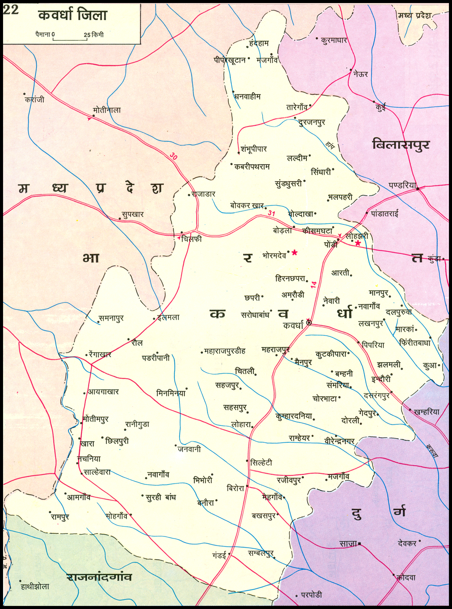
| विवरण (Description) | कवर्धा ज़िले का मानचित्र |
| अन्य विवरण | छत्तीसगढ़ राज्य के कवर्धा ज़िले का क्षेत्रफल 3,956 वर्ग किमी है। |
File history
फ़ाइल पुराने समय में कैसी दिखती थी यह जानने के लिए वांछित दिनांक/समय पर क्लिक करें।
| Date/Time | अंगुष्ठ नखाकार (थंबनेल) | Dimensions | User | Comment | |
|---|---|---|---|---|---|
| current | 14:12, 3 February 2011 | | 1,474 × 1,987 (2.7 MB) | गोविन्द राम (talk | contribs) | |
| 13:07, 3 February 2011 | 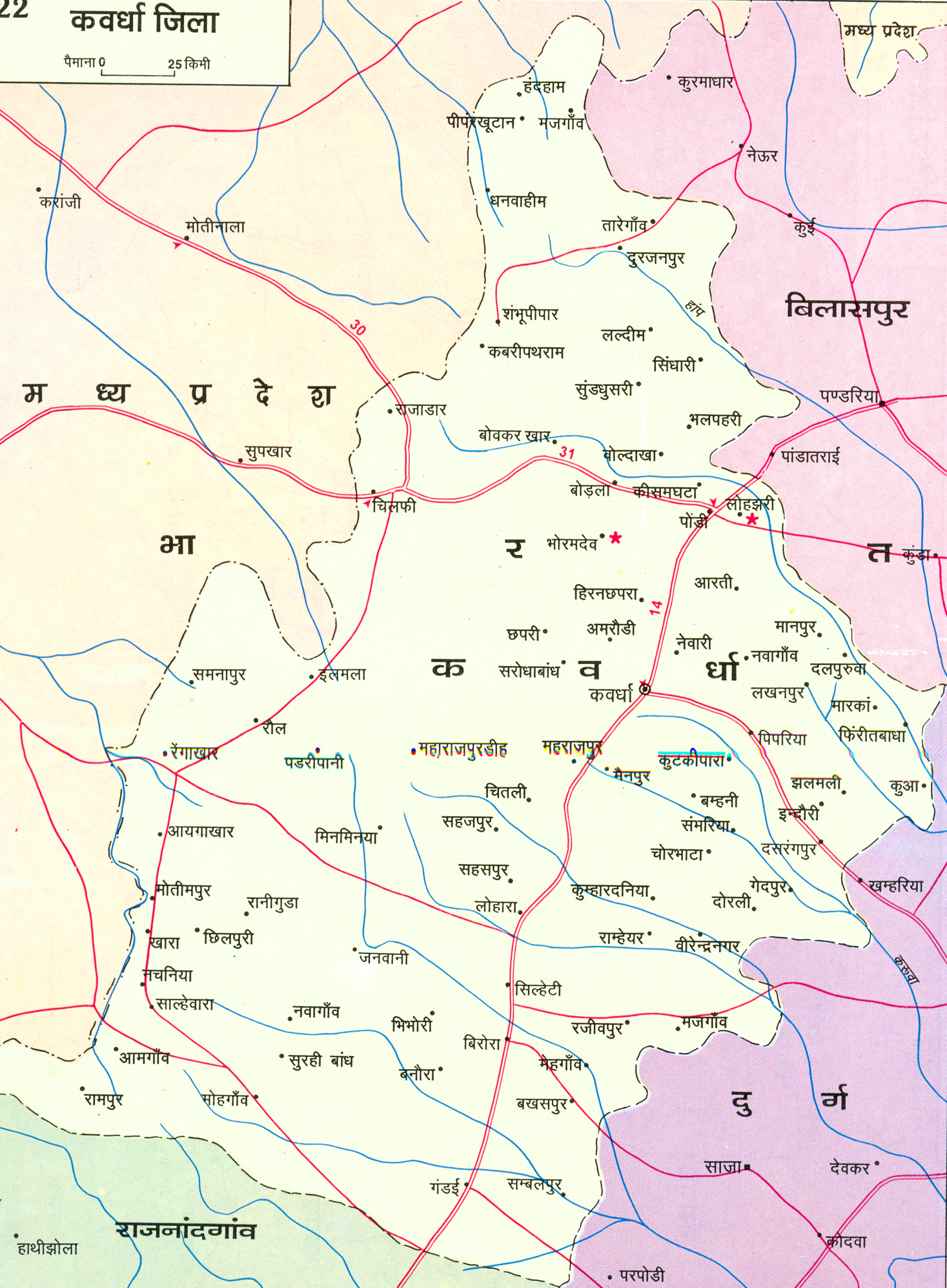 | 1,467 × 1,996 (2.99 MB) | गोविन्द राम (talk | contribs) |
You cannot overwrite this file.
File usage
The following page uses this file: