File:Map Braun Hogenberg Goa.jpg
No higher resolution available.
Map_Braun_Hogenberg_Goa.jpg (500 × 366 pixels, file size: 160 KB, MIME type: image/jpeg)
| विवरण (Description) | गोवा का ऐतिहासिक मानचित्र |
| चित्रांकन (Author) | Frederick Noronha |
| स्रोत (Source) | www.flickr.com |
| उपलब्ध (Available) | Antique_Map_Braun_Hogenberg_Goa |
| आभार (Credits) | fredericknoronha's photostream |
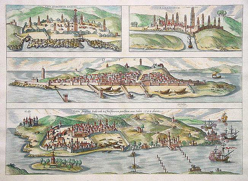
| अन्य विवरण | गोवा प्राचीनकाल में गोमांचल, गोपकपट्टनम, गोपपुरी, और गोमांतक आदि कई नामों से विख्यात रहा है। इस प्रदेश की लंबी ऐतिहासिक परंपरा रही है। गोवा पश्चिमी समुद्र तट पर स्थित भूतपूर्व पुर्तग़ाली बस्ती है, जो 1961 से भारत का अभिन्न अंग बन गई। |
|
इस चित्र का चयन मुखपृष्ठ के लिए किया गया है। सभी चयनित चित्र देखें |
|
यह चित्र क्रिएटिव कॉमन्स लाइसेंस के अंतर्गत उसके 'उपयोग के अधिकारों' का हनन किए बिना उपयोग किया गया है। कृपया चित्र के उपयोग अधिकार देखे बिना उनका उपयोग न करें। इससे चित्रों से संबधित अधिकारों के उल्लंघन होने की संभावना है। |
100px|link=http://creativecommons.org/licenses/by-nc/2.0/legalcode|center
|
This file is used under the Creative Commons license. |
| 30px|Attribution Attribution - आपको चित्र के "अधिकार धारक" का उल्लेख उसके निर्देशानुसार करना होगा किन्तु इससे यह प्रतीत नहीं होना चाहिए कि "अधिकार धारक" आपके अपने कार्य का समर्थन कर रहा है। [You must attribute the work in the manner specified by the author or licensor (but not in any way that suggests that they endorse you or your use of the work).] | ||
| 30px|No Derivative Works No Derivative Works - आप इस चित्र का संपादन नहीं कर सकते [You may not alter, transform, or build upon this work.] | ||
File history
फ़ाइल पुराने समय में कैसी दिखती थी यह जानने के लिए वांछित दिनांक/समय पर क्लिक करें।
| Date/Time | अंगुष्ठ नखाकार (थंबनेल) | Dimensions | User | Comment | |
|---|---|---|---|---|---|
| current | 11:32, 9 January 2011 | | 500 × 366 (160 KB) | गोविन्द राम (talk | contribs) |
You cannot overwrite this file.
File usage
The following 2 pages use this file: